Services

Terrain models

Terrain Models (DTM & DSM)

Accurate ground and surface models for planning, engineering, and analysis

Terrain models form the foundation of modern geospatial and engineering workflows. Using drone-based LiDAR and photogrammetry, highly accurate representations of both bare terrain and surface features can be generated across complex environments.

FROST delivers precise Digital Terrain Models (DTM) and Digital Surface Models (DSM) tailored to project requirements — providing reliable datasets for design, analysis, and decision-making.

What is the difference between DTM and DSM?

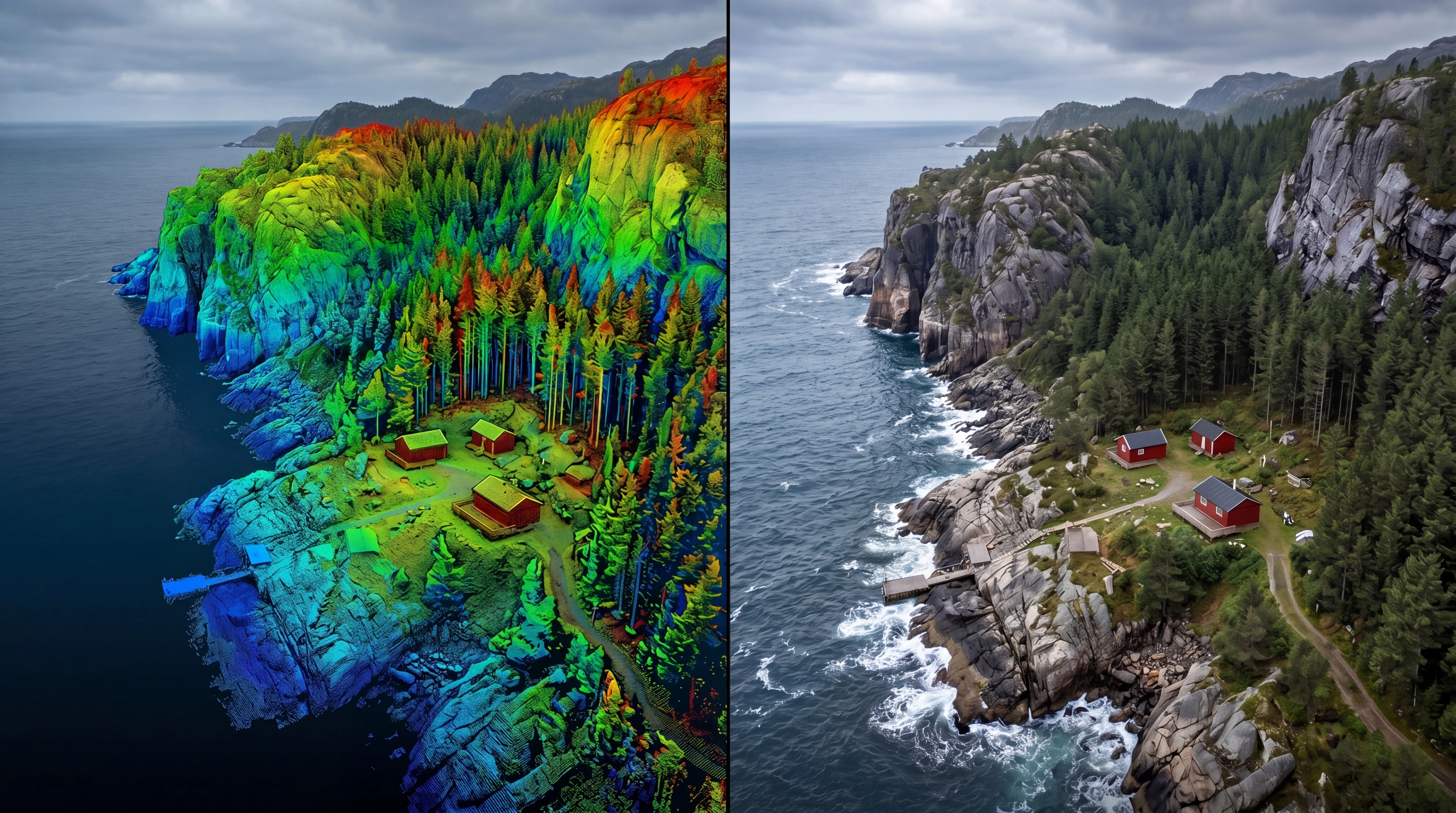
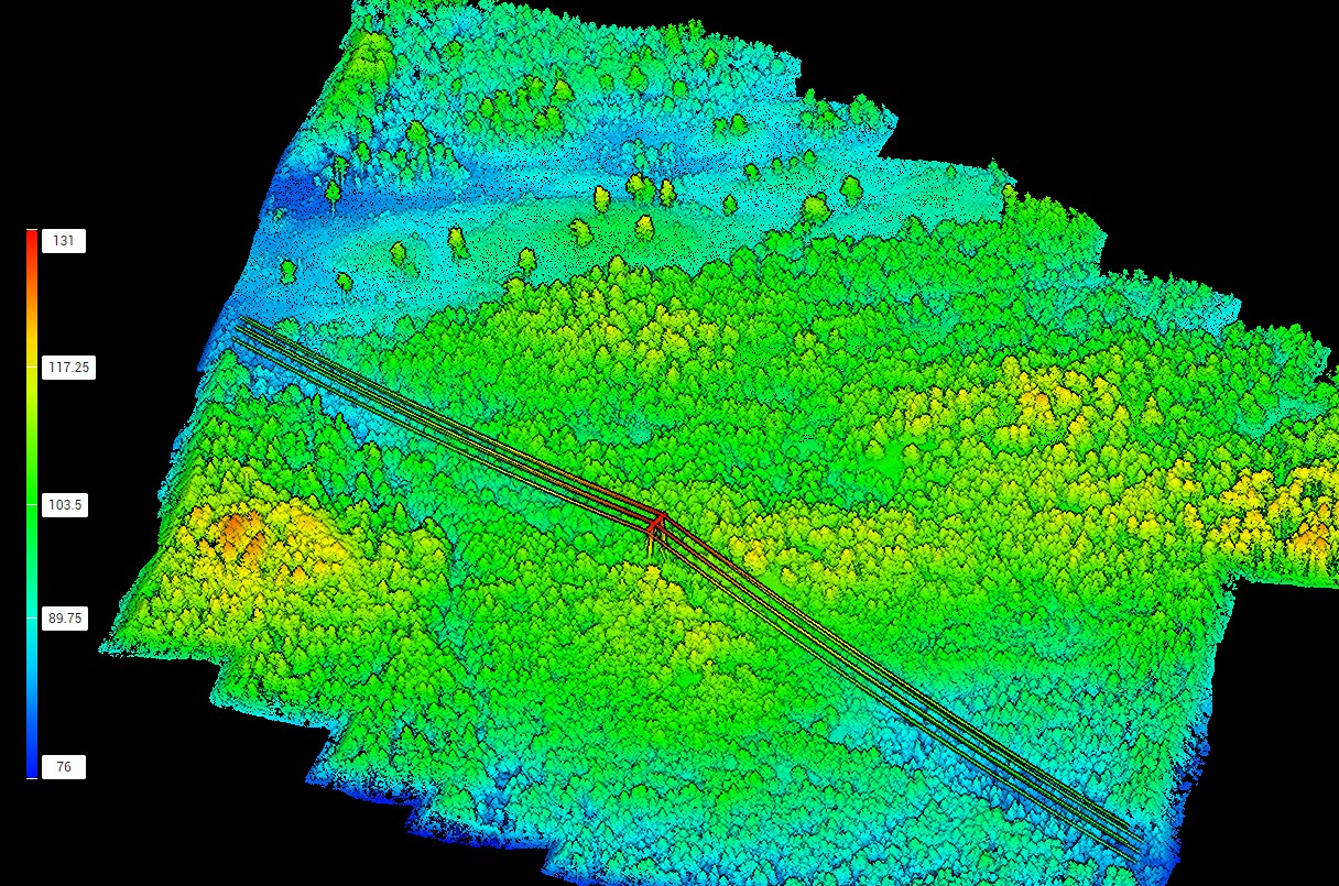
Terrain and surface models represent different aspects of the landscape.

DTM (Digital Terrain Model)

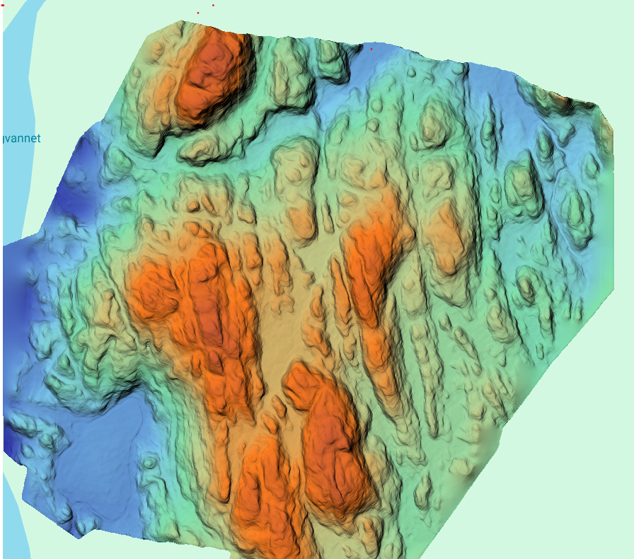
Represents the bare ground surface with vegetation and objects removed.

Typically used for:
  • Drainage and hydrological analysis
  • Terrain modelling
  • Infrastructure and engineering design
  • Earthworks planning

DSM (Digital Surface Model)

Represents everything visible on the surface, including:
  • Vegetation
  • Buildings
  • Infrastructure
  • Other above-ground objects
Typically used for:
  • Surface analysis
  • Visualization
  • Volume calculations
  • Urban and environmental modelling

Together, DTM and DSM datasets provide a complete understanding of terrain shape and surface conditions.

Applications
Terrain models support a wide range of geospatial and engineering workflows:
  • Infrastructure planning for roads, railways, and utilities
  • Construction and earthworks design
  • Flood modelling and hydrological analysis
  • Volume calculations and mass balance
  • Urban and land-use planning
  • Environmental and landscape analysis
  • Base datasets for GIS, CAD, and BIM workflows
Data acquisition and processing
FROST uses drone-mounted LiDAR systems and high-resolution imagery to generate accurate terrain datasets.
Our workflow includes:
  • High-density LiDAR and photogrammetric data capture
  • GNSS and ground control for precise positioning
  • Classification of terrain and surface features
  • Generation of clean and consistent terrain models

This enables reliable results even in:

  • Dense vegetation
  • Steep or complex terrain
  • Urban environments with mixed structures
Accuracy and quality
High-quality terrain models depend on both accurate data capture and robust processing workflows.
FROST ensures:
  • Accurate ground classification
  • High spatial resolution
  • Consistent model quality across the project area
  • Reliable elevation data for engineering and analysis

LiDAR-based DTMs are particularly effective in vegetated environments where traditional surveying methods are limited.

Deliverables
We deliver terrain datasets ready for direct integration into professional workflows, including:
  • Digital Terrain Models (DTM)
  • Digital Surface Models (DSM)
  • Grid models and raster datasets
  • GIS- and CAD-ready files
Topographical LiDAR
Bathymetric LiDAR
Powerline inspection

Geospatial solutions powered by software, sensors, and AI technologies

Join us and help capture and transform accurate geospatial data into valuable insights and digital twins.

Join us
Terrain Models (DTM & DSM)

Terrain models

Accurate ground and surface models for planning, engineering, and analysis

Terrain models form the foundation of modern geospatial and engineering workflows. Using drone-based LiDAR and photogrammetry, highly accurate representations of both bare terrain and surface features can be generated across complex environments.

FROST delivers precise Digital Terrain Models (DTM) and Digital Surface Models (DSM) tailored to project requirements — providing reliable datasets for design, analysis, and decision-making.