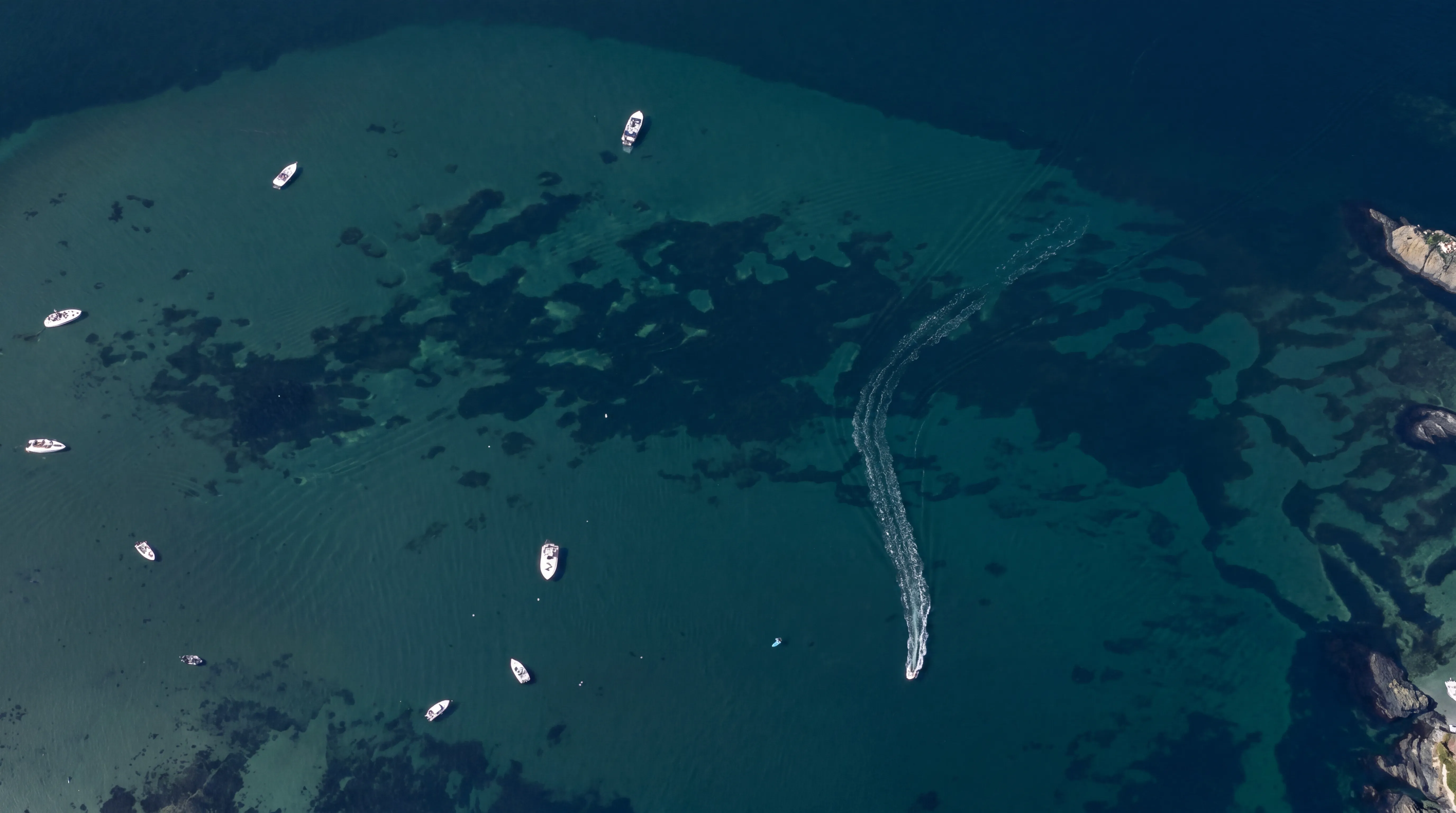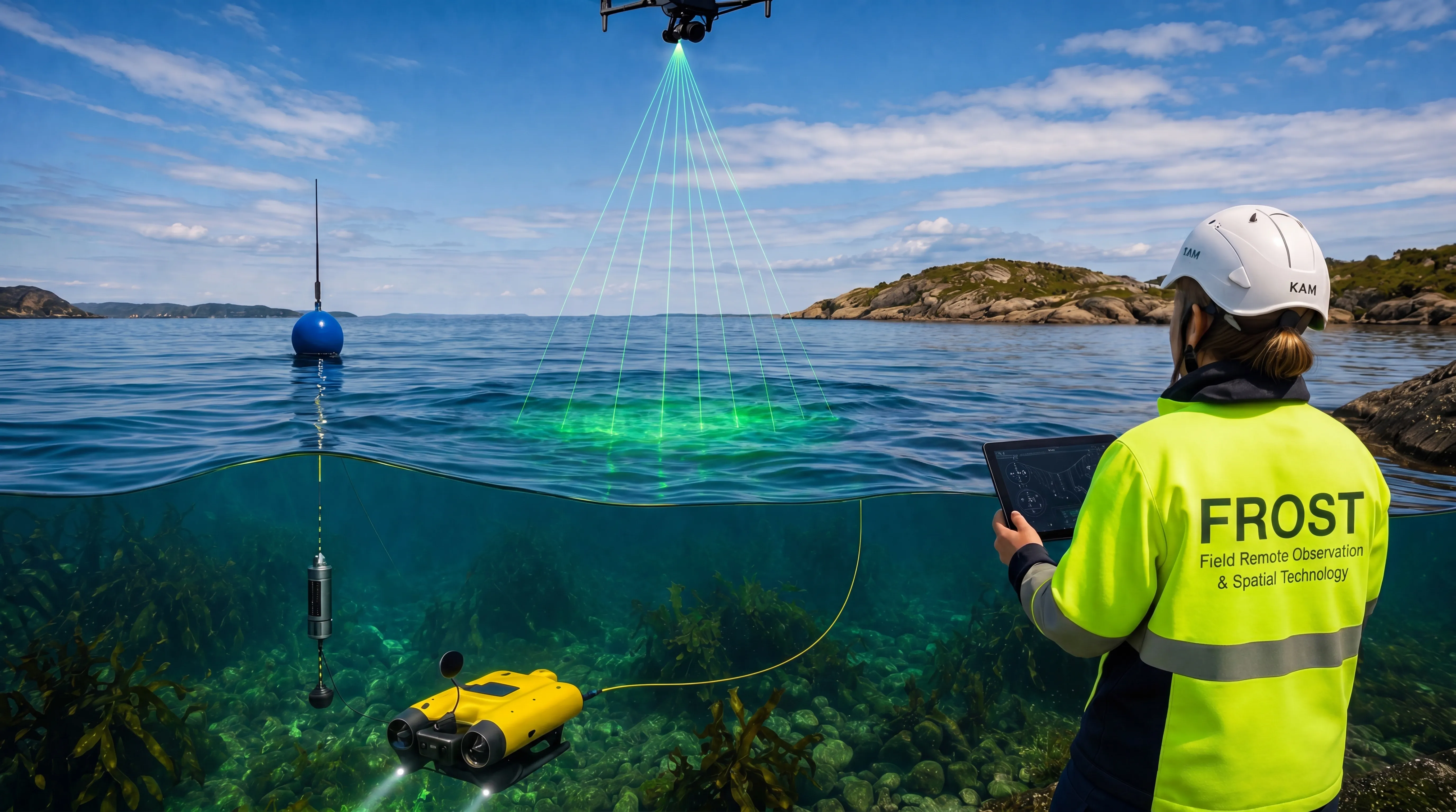
FROST maps and monitors natural and aquatic environments across land, rivers, lakes, coastal zones and shallow water areas.
Using drone-based LiDAR, bathymetric mapping, ROV inspection and environmental sensors, we document terrain, shorelines, riverbeds, shallow seabeds, vegetation, erosion and change over time.
The result is reliable, decision-ready data for environmental assessments, planning, climate adaptation, construction follow-up and long-term management.