Services

Linear Infrastructure Mapping

Linear Infrastructure Mapping

High-precision corridor mapping for roads, railways, and power infrastructure

Mapping linear infrastructure requires accurate and continuous data capture across long distances — often in complex terrain and challenging environments. Drone-based LiDAR and high-resolution imaging provide an efficient and reliable method for capturing corridor data used in planning, engineering, maintenance, and documentation workflows.

FROST delivers consistent, high-quality datasets for infrastructure corridors, supporting analysis, asset management, and engineering processes.

Why drone-based corridor mapping?
Traditional corridor surveying can be time-consuming, resource-intensive, and difficult in remote or hazardous environments. Drone-based workflows improve efficiency while maintaining high spatial accuracy.
Key advantages include:
  • Rapid data acquisition across large corridor areas
  • Safe operations in difficult or inaccessible terrain
  • High point density and complete corridor coverage
  • Reduced need for ground-based surveying

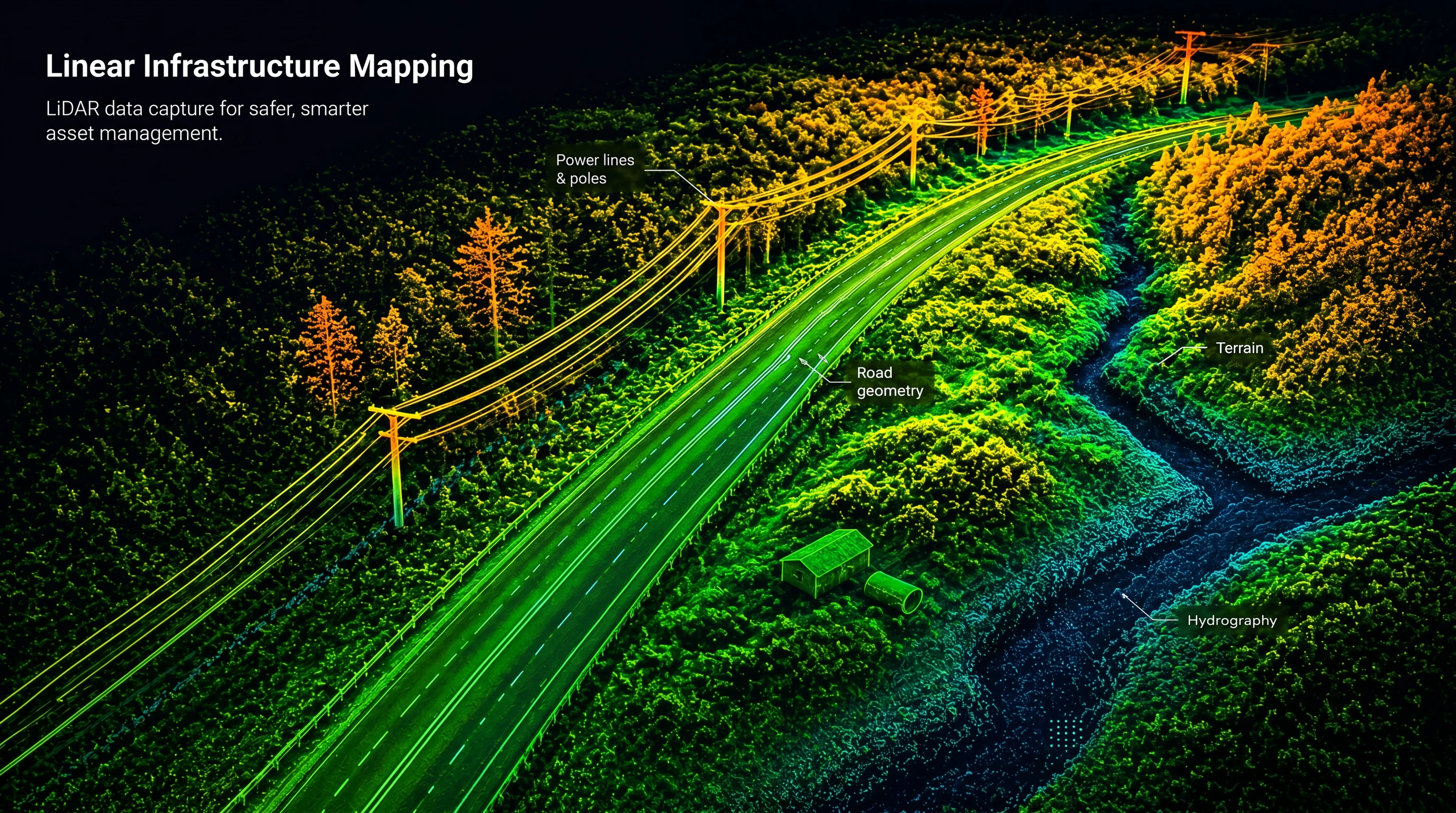
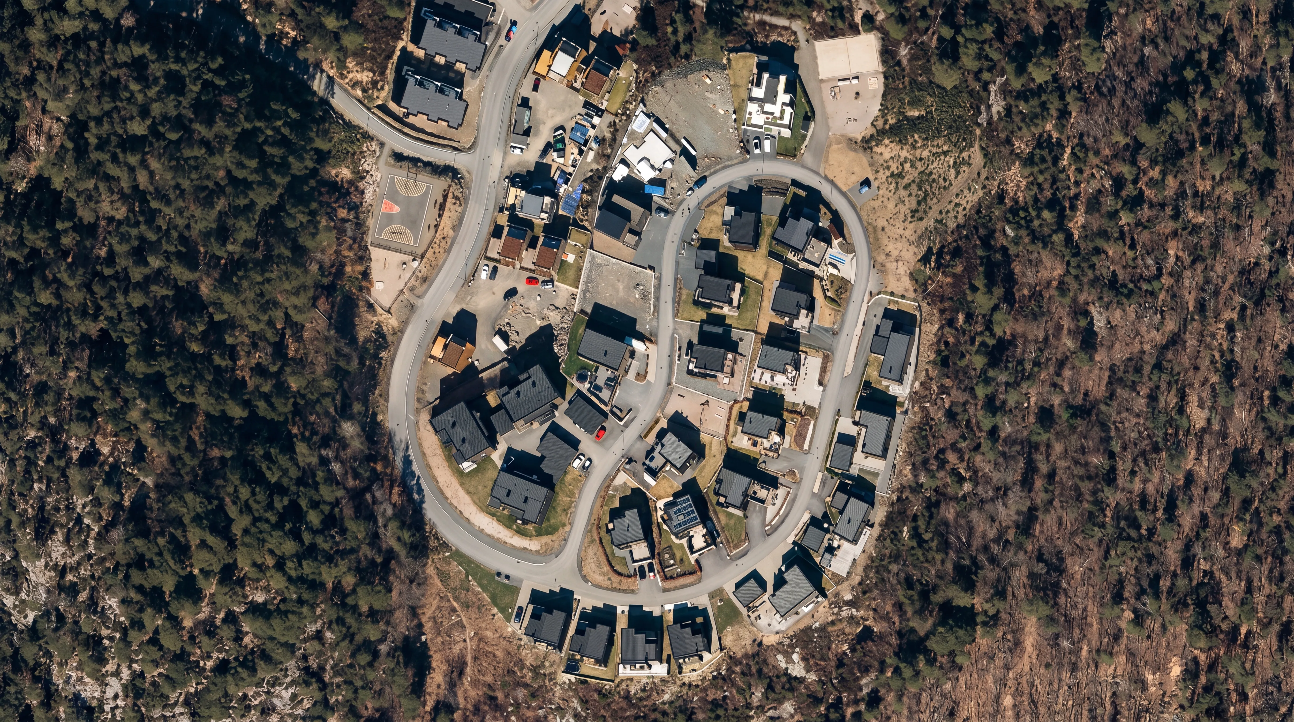
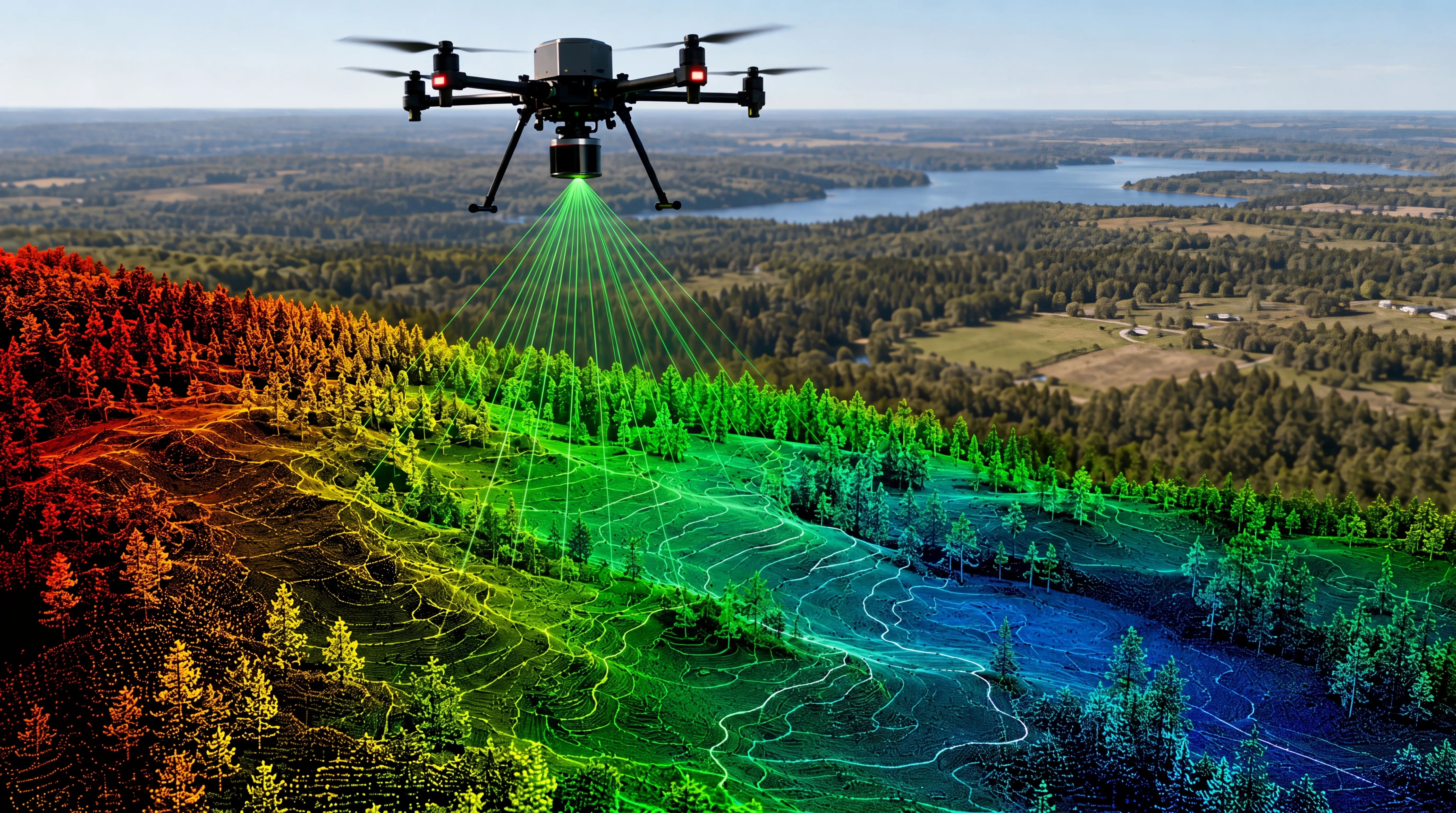
Using LiDAR, vegetation can be penetrated to capture the true ground surface — critical for accurate terrain modelling along infrastructure corridors.

Applications
Typical applications include:
  • Powerline and transmission corridor mapping
  • Road and highway planning and documentation
  • Railway corridor mapping and analysis
  • Pipeline and cable route mapping
  • Infrastructure inspection and asset documentation
  • Vegetation analysis and clearance monitoring
  • As-built documentation and project follow-up
Data quality and workflow
FROST combines drone-mounted LiDAR, high-resolution imagery, and precise GNSS/IMU positioning to ensure reliable and consistent datasets.
Each project is adapted to:
  • Corridor length and width
  • Terrain and vegetation conditions
  • Required accuracy and data density
Our workflows ensure:
  • Continuous and overlapping coverage
  • Accurate georeferencing
  • Reliable classification of terrain and infrastructure features
  • Seamless integration into GIS, CAD, and BIM environments
Accuracy and reliability
Linear infrastructure projects require consistent data quality across large geographical areas.
FROST ensures:
  • High horizontal and vertical accuracy
  • Uniform point density throughout the corridor
  • Reliable ground classification in vegetated terrain
  • Repeatable datasets for monitoring and change detection
Deliverables
We deliver analysis-ready corridor datasets, including:
  • Classified point clouds (LAS / LAZ)
  • Digital Terrain Models (DTM)
  • Digital Surface Models (DSM)
  • Orthophotos and imagery datasets
  • GIS- and CAD-ready files
  • Corridor mapping deliverables for engineering workflows
Topographical LiDAR
Bathymetric LiDAR
Powerline inspection

Geospatial solutions powered by software, sensors, and AI technologies

Join us and help capture and transform accurate geospatial data into valuable insights and digital twins.

Join us
Linear Infrastructure Mapping

Linear Infrastructure Mapping

High-precision corridor mapping for roads, railways, and power infrastructure

Mapping linear infrastructure requires accurate and continuous data capture across long distances — often in complex terrain and challenging environments. Drone-based LiDAR and high-resolution imaging provide an efficient and reliable method for capturing corridor data used in planning, engineering, maintenance, and documentation workflows.

FROST delivers consistent, high-quality datasets for infrastructure corridors, supporting analysis, asset management, and engineering processes.