Services

Environmental monitoring and change analysis

Environmental monitoring and change analysis

FROST helps clients document, monitor and understand changes in natural, coastal and aquatic environments.

Through repeat surveys, drone-based mapping, LiDAR, bathymetric data, ROV inspection and environmental sensors, we deliver structured datasets that make it possible to compare conditions before, during and after a project.

Our monitoring solutions support environmental documentation, impact assessment, erosion analysis, climate adaptation, construction follow-up and long-term management of land and water environments.

What we monitor
Environmental monitoring can include changes in:
  • Terrain and surface conditions
  • Riverbeds, shorelines and shallow water areas
  • Seabed morphology and bottom structures
  • Erosion, sediment transport and deposition
  • Vegetation, habitat and aquatic environments
  • Water quality and environmental parameters
  • Impacts from infrastructure, construction or mitigation measures

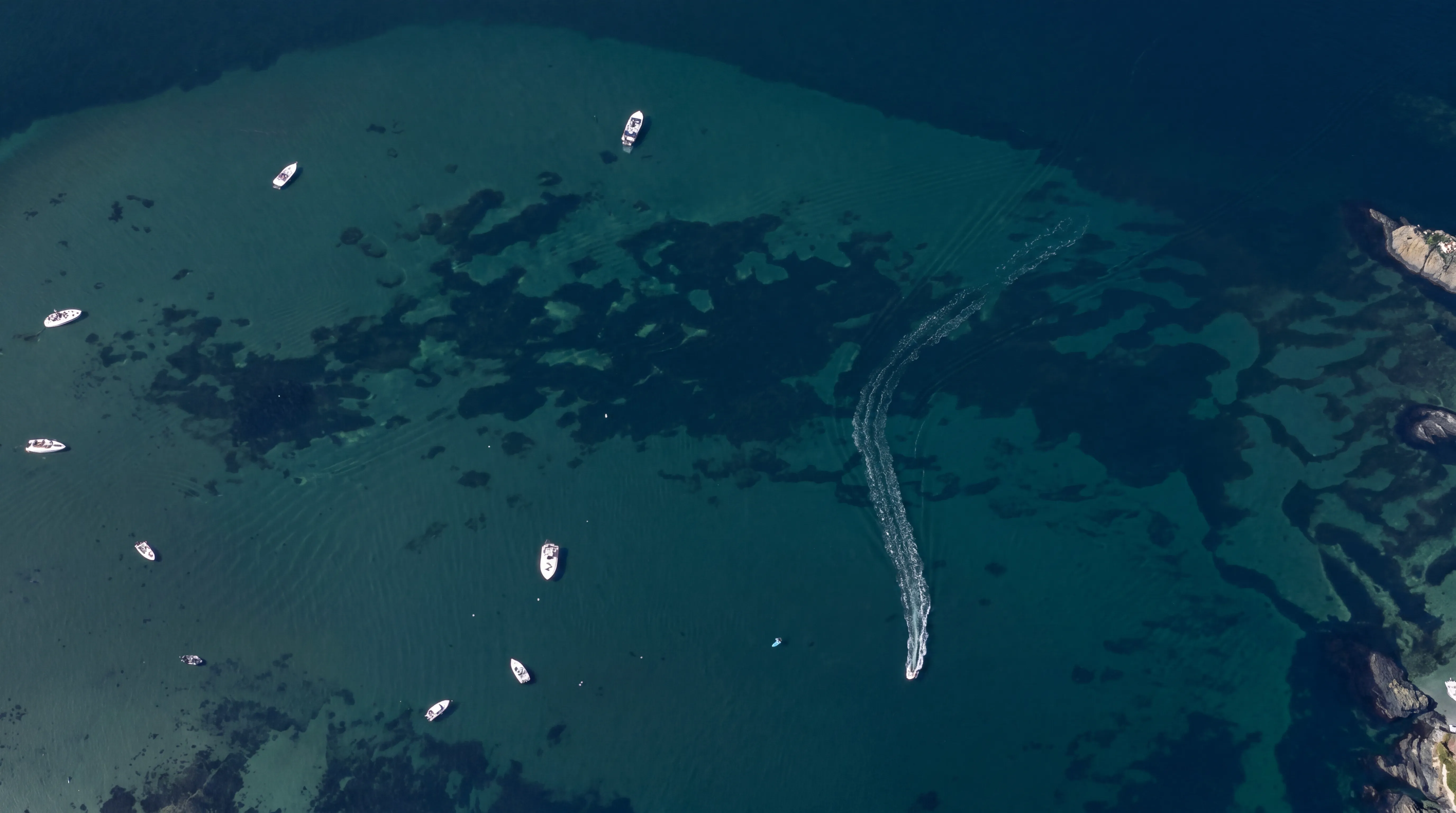
By combining spatial data with environmental measurements, FROST helps identify trends, deviations and changes over time.

Methods and data sources
FROST combines several data sources to create repeatable and analysis-ready monitoring datasets:
  • Drone-based LiDAR and photogrammetry
  • Bathymetric LiDAR for shallow water environments
  • ROV inspection and underwater documentation
  • GNSS-based control and field measurements
  • Environmental sensors for water quality data
  • GIS-based analysis and multi-temporal comparison

This makes it possible to compare the same area across different survey dates and document physical or environmental change with high spatial accuracy.

Environmental sensors
Underwater and aquatic monitoring may include measurements such as:
  • Temperature
  • Turbidity
  • Dissolved oxygen, O₂
  • pH

These measurements can support mapping of aquatic habitats, water conditions, sediment disturbance, environmental impact and changes related to construction or natural processes.

Typical applications and deliverables
FROST supports monitoring and change analysis for:
  • Environmental monitoring programs
  • Environmental impact assessments
  • Climate adaptation and natural hazard assessment
  • Flood, erosion and sediment analysis
  • Construction impact monitoring
  • Shoreline and riverbank change detection
  • Shallow water and seabed documentation
  • Habitat and aquatic environment mapping
  • Before, during and after documentation
  • Reporting to authorities, clients and stakeholders

Depending on the project, FROST can deliver:
  • Multi-temporal comparison datasets
  • Change detection analysis
  • Classified point clouds, LAS / LAZ
  • Terrain and surface models, DTM / DSM
  • Bathymetric models for shallow water areas
  • Orthophotos and map products
  • ROV images, video and inspection documentation
  • Environmental sensor datasets, CSV / GIS-ready formats
  • Reports, maps and visualizations
  • GIS-, CAD- and BIM-ready files
Relevant for
This service is relevant for:
  • Municipalities and public authorities
  • Environmental consultants
  • Engineering consultants
  • Contractors
  • Infrastructure owners
  • Coastal and water management projects
  • Climate adaptation and natural hazard projects
  • Construction projects near rivers, lakes or coastal areas
Topographical LiDAR
Bathymetric LiDAR
Powerline inspection

Geospatial solutions powered by software, sensors, and AI technologies

Join us and help capture and transform accurate geospatial data into valuable insights and digital twins.

Join us
Environmental monitoring and change analysis

Environmental monitoring and change analysis

FROST helps clients document, monitor and understand changes in natural, coastal and aquatic environments.

Through repeat surveys, drone-based mapping, LiDAR, bathymetric data, ROV inspection and environmental sensors, we deliver structured datasets that make it possible to compare conditions before, during and after a project.

Our monitoring solutions support environmental documentation, impact assessment, erosion analysis, climate adaptation, construction follow-up and long-term management of land and water environments.