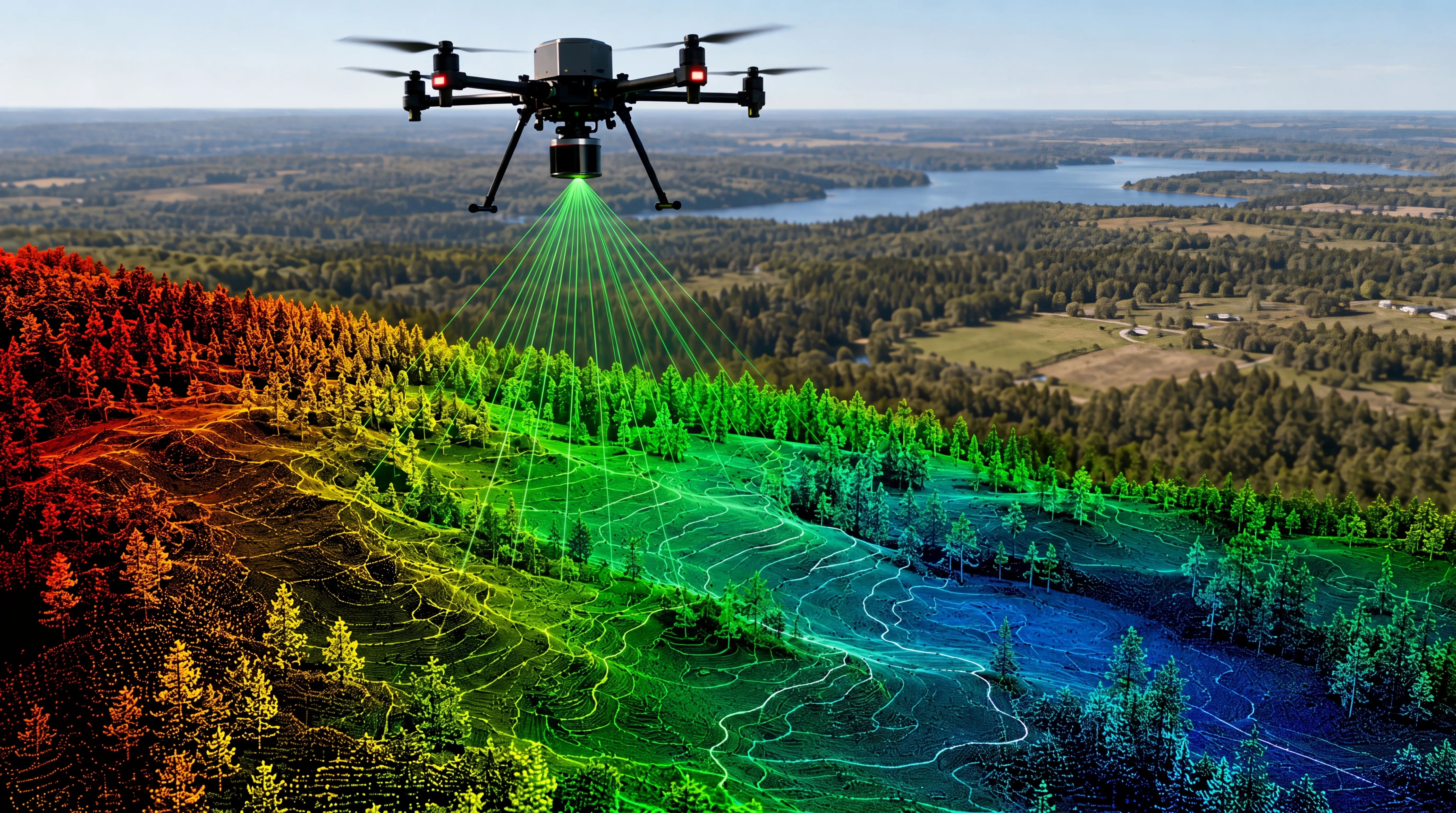
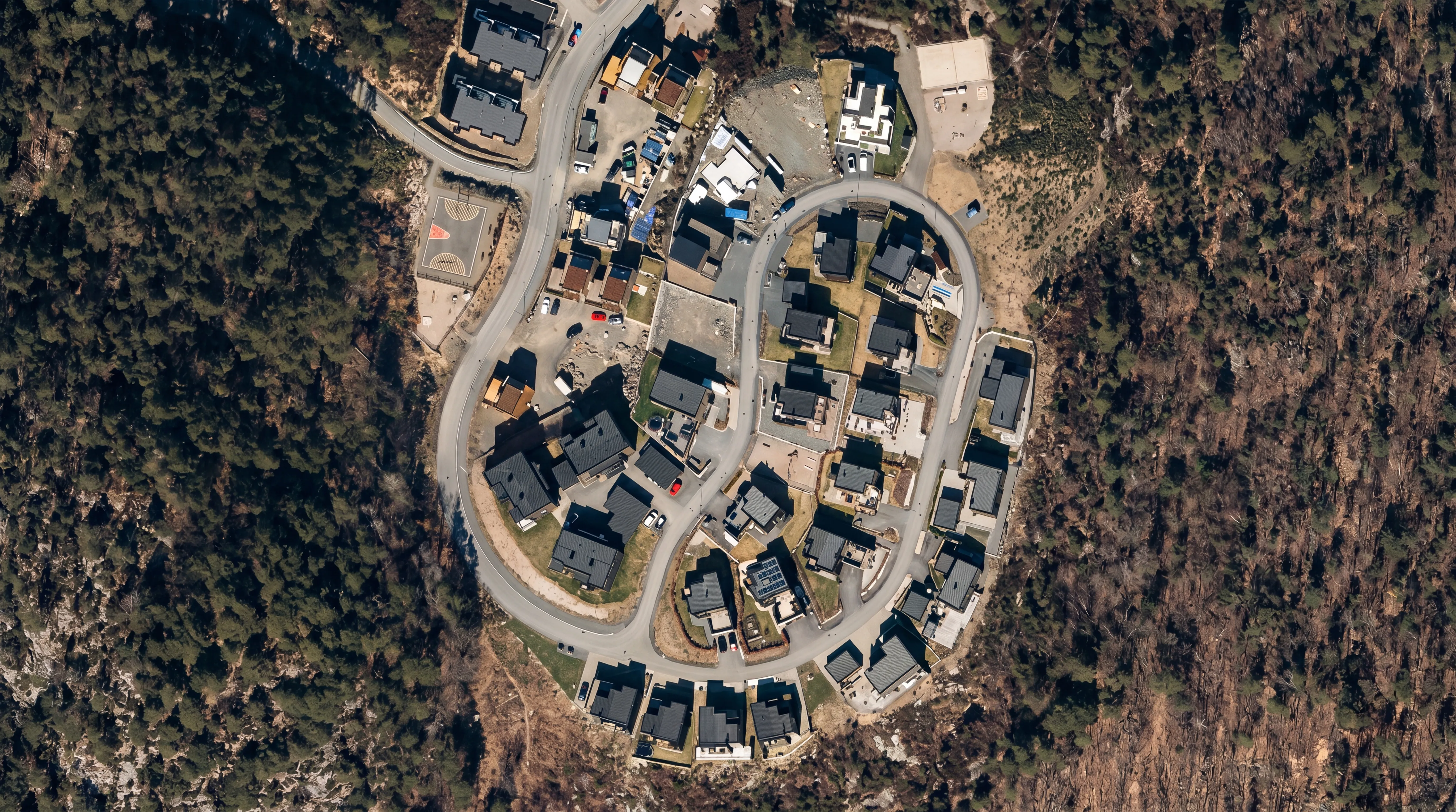
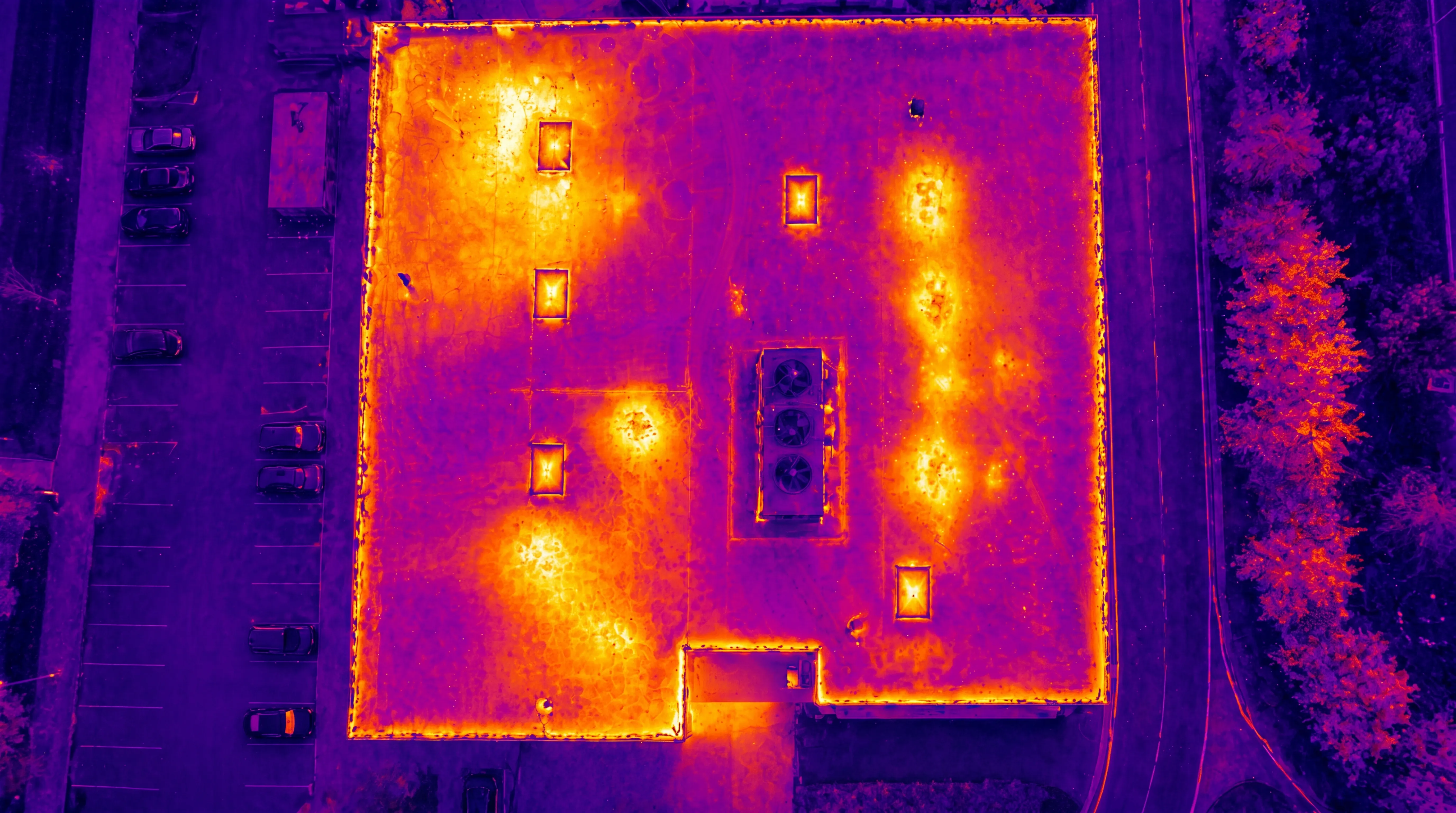
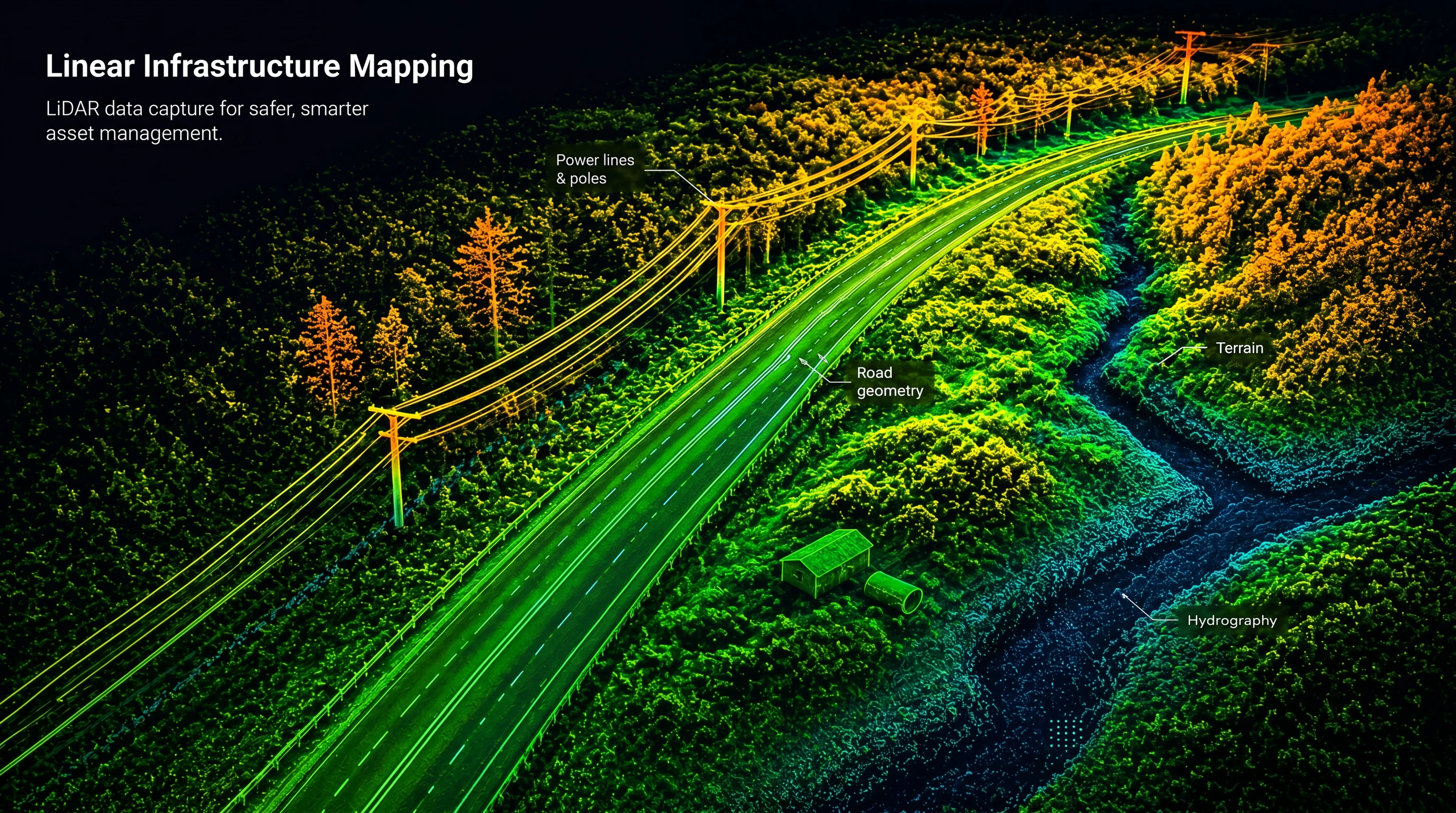
We capture accurate, high-resolution data using advanced drone-based sensors — enabling better decisions in planning, engineering, and environmental analysis.
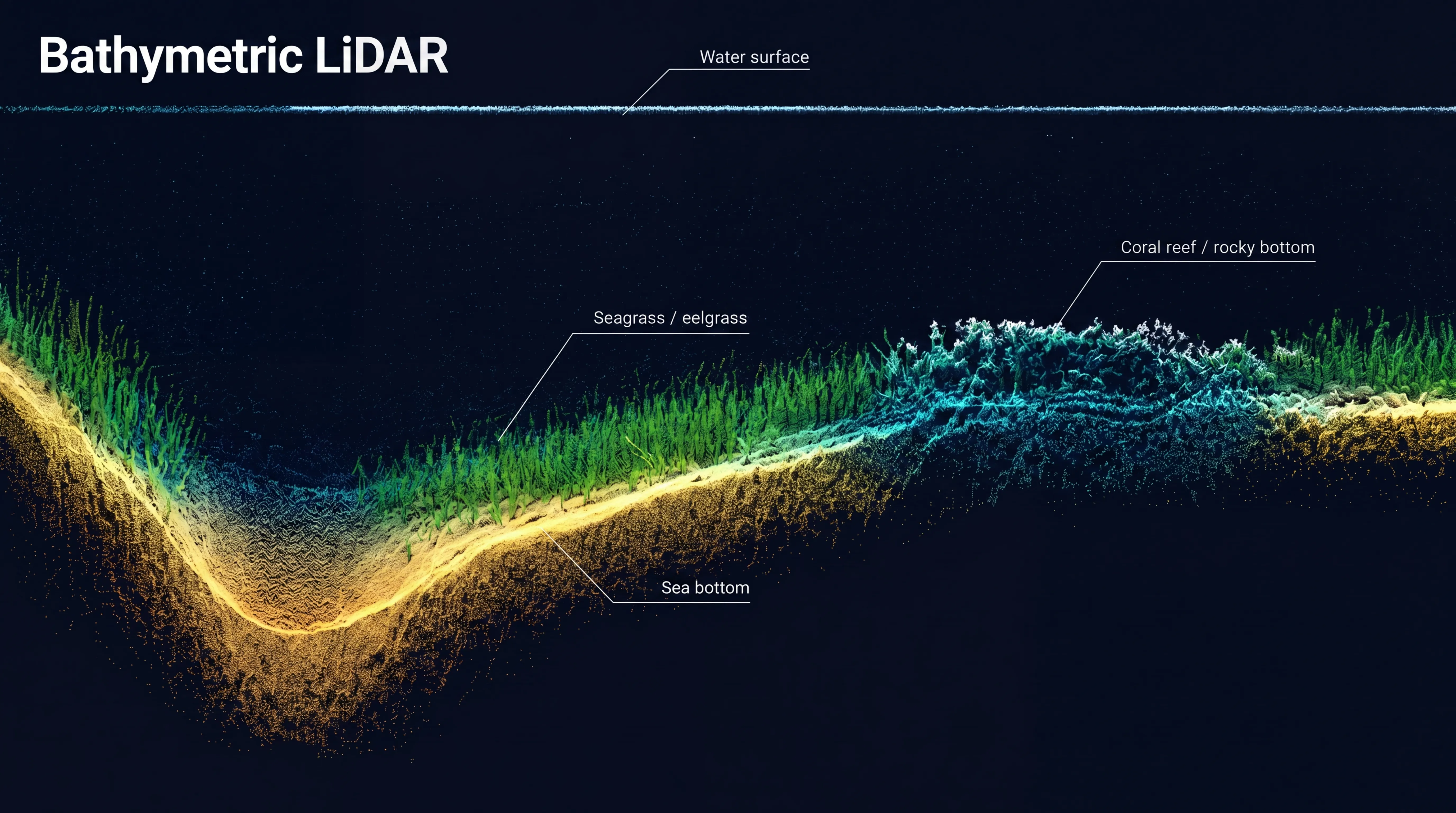
By combining LiDAR, photogrammetry, thermal imaging, and bathymetric mapping, FROST delivers reliable datasets across complex and hard-to-access environments.
Our workflows support consistent data quality across terrain, infrastructure, shallow water, and below-surface environments.