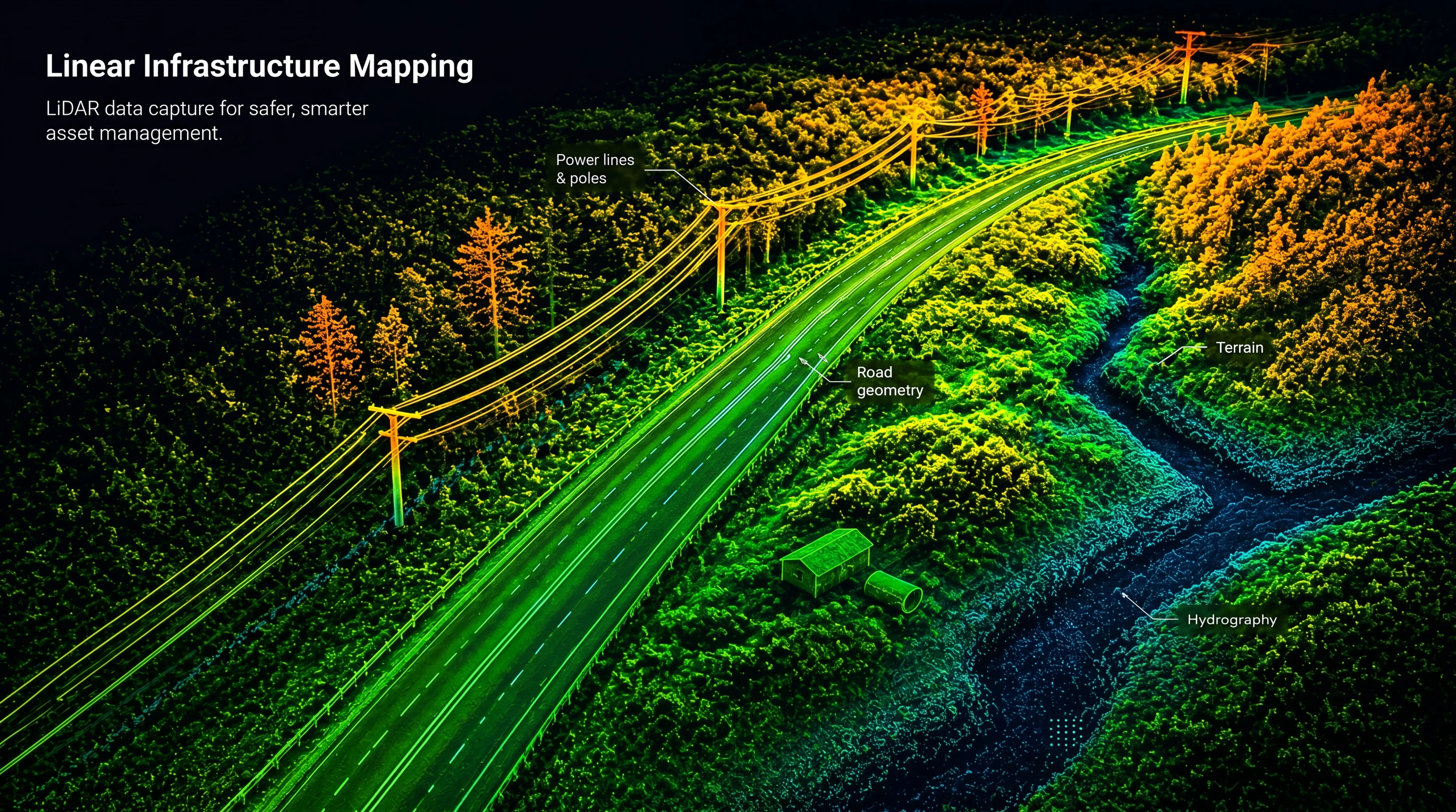
Services

Bathymetric LiDAR

Bathymetric LiDAR with Drones (Green Laser)

High-resolution mapping of shallow water and the seabed

Bathymetric LiDAR uses green laser technology mounted on drones to map terrain both above and below water. This enables fast and accurate surveying of shallow coastal zones, rivers, lakes, and inland waters — environments that are often difficult or costly to survey using traditional methods.

FROST delivers seamless land-to-water datasets supporting engineering, infrastructure planning, environmental analysis, and long-term monitoring.

Why Bathymetric LiDAR?
Green wavelength lasers penetrate water, enabling simultaneous mapping of:
  • Terrain above water
  • Water surface
  • Seabed or riverbed

This creates a continuous elevation model across shoreline environments, providing reliable datasets where land and water interact.

Bathymetric LiDAR is particularly suited for:
  • Shallow and nearshore environments
  • Clear water conditions
  • Areas where boat-based surveys are inefficient or limited
Applications
Typical applications include:
  • Coastal and shoreline mapping
  • Rivers, floodplains, lakes, and reservoirs
  • Infrastructure near water such as roads, bridges, and cables
  • Environmental monitoring and habitat mapping
  • Sediment transport and erosion analysis
  • Baseline datasets for GIS and digital twin workflows
Data quality and survey conditions
Bathymetric survey performance depends on several environmental factors, including:
  • Water clarity and depth
  • Bottom type and reflectivity
  • Weather conditions and sun angle

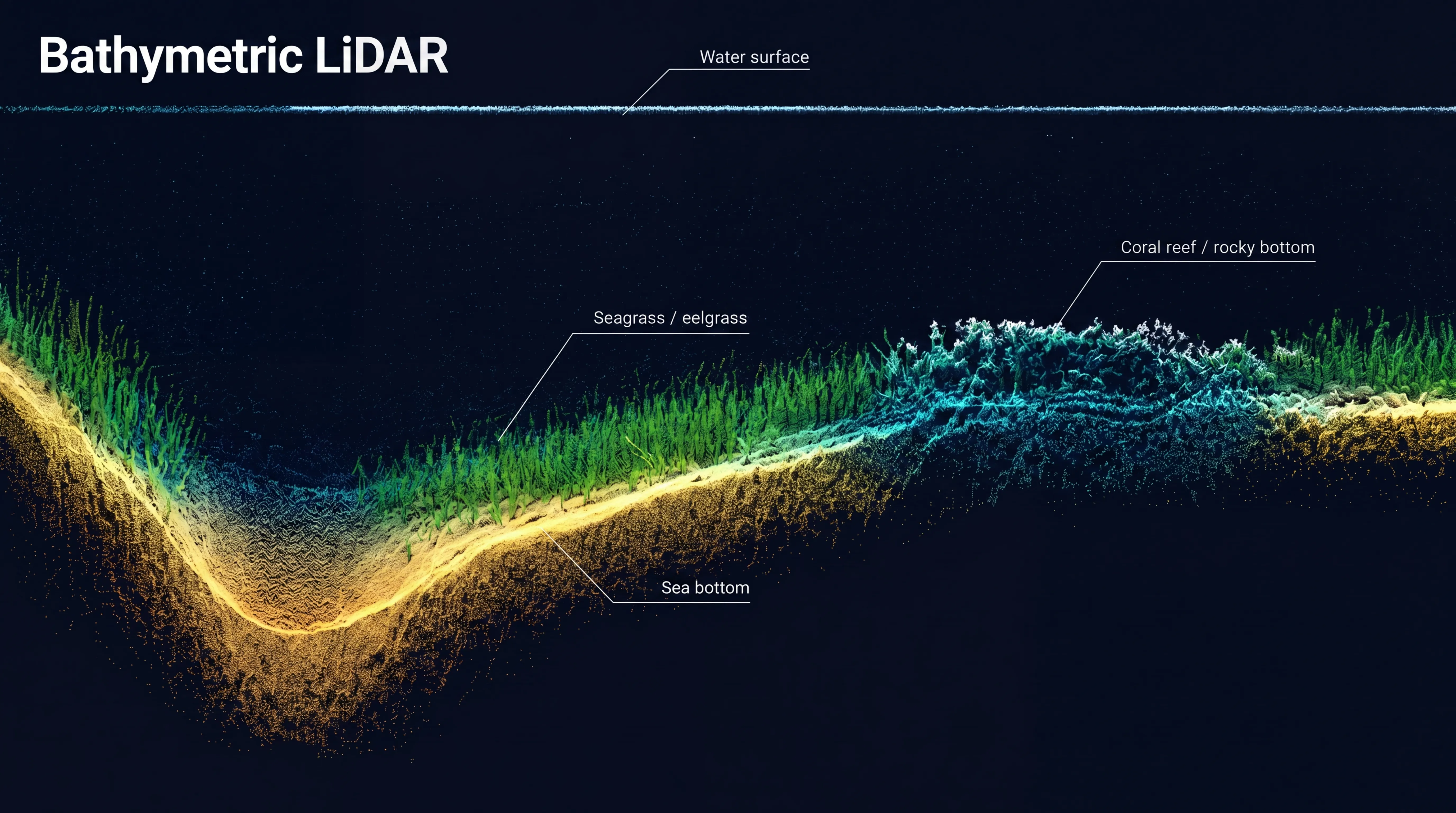
FROST carefully plans each mission and combines bathymetric LiDAR with precise GNSS/IMU positioning to ensure accurate georeferencing and consistent results.

Where required, datasets can be complemented with:
  • ROV (underwater drone) inspections
  • Environmental sensor measurements
  • High-resolution RGB imagery
Deliverables
We provide analysis-ready bathymetric datasets, including:
  • Bathymetric point clouds (LAS / LAZ)
  • Seamless land–water terrain models
  • Digital Terrain Models (DTM) including seabed
  • Contours and elevation datasets
  • GIS- and CAD-ready files
Need data in and around water?

Get in touch to discuss your project — we’ll help define the right bathymetric mapping approach based on your environment, accuracy requirements, and project goals.

Topographical LiDAR
Bathymetric LiDAR
Powerline inspection

Geospatial solutions powered by software, sensors, and AI technologies

Join us and help capture and transform accurate geospatial data into valuable insights and digital twins.

Join us
Bathymetric LiDAR with Drones (Green Laser)

Bathymetric LiDAR

High-resolution mapping of shallow water and the seabed

Bathymetric LiDAR uses green laser technology mounted on drones to map terrain both above and below water. This enables fast and accurate surveying of shallow coastal zones, rivers, lakes, and inland waters — environments that are often difficult or costly to survey using traditional methods.

FROST delivers seamless land-to-water datasets supporting engineering, infrastructure planning, environmental analysis, and long-term monitoring.